
Mappedin makes indoor navigation effortless.

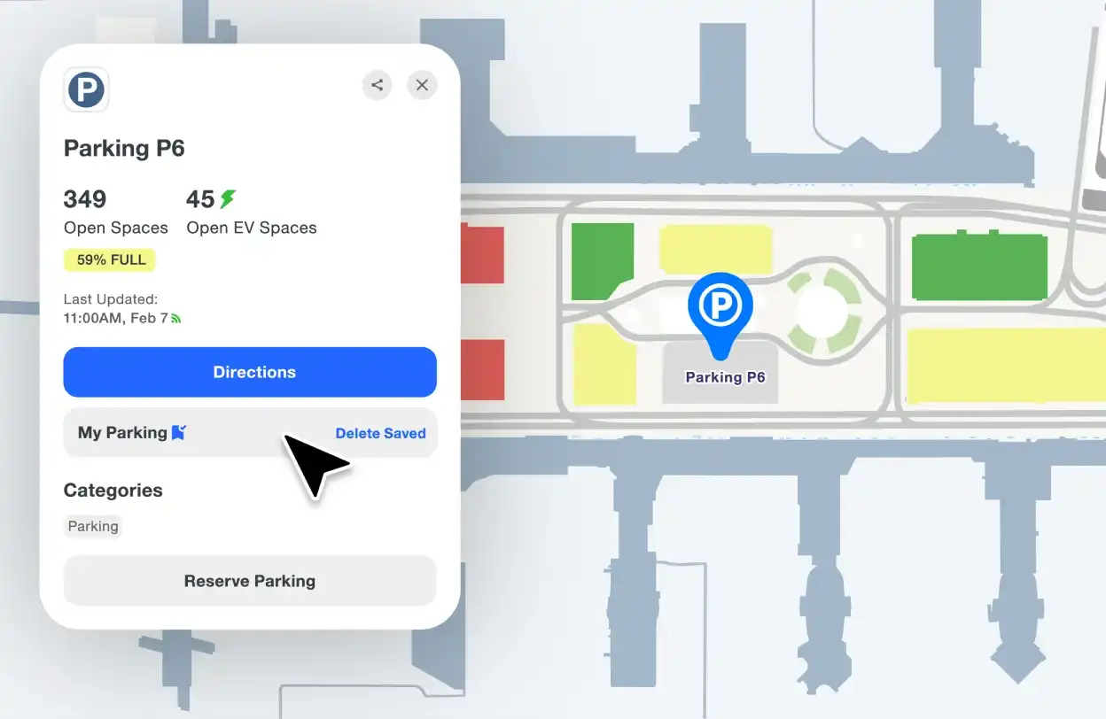
Parking made easy
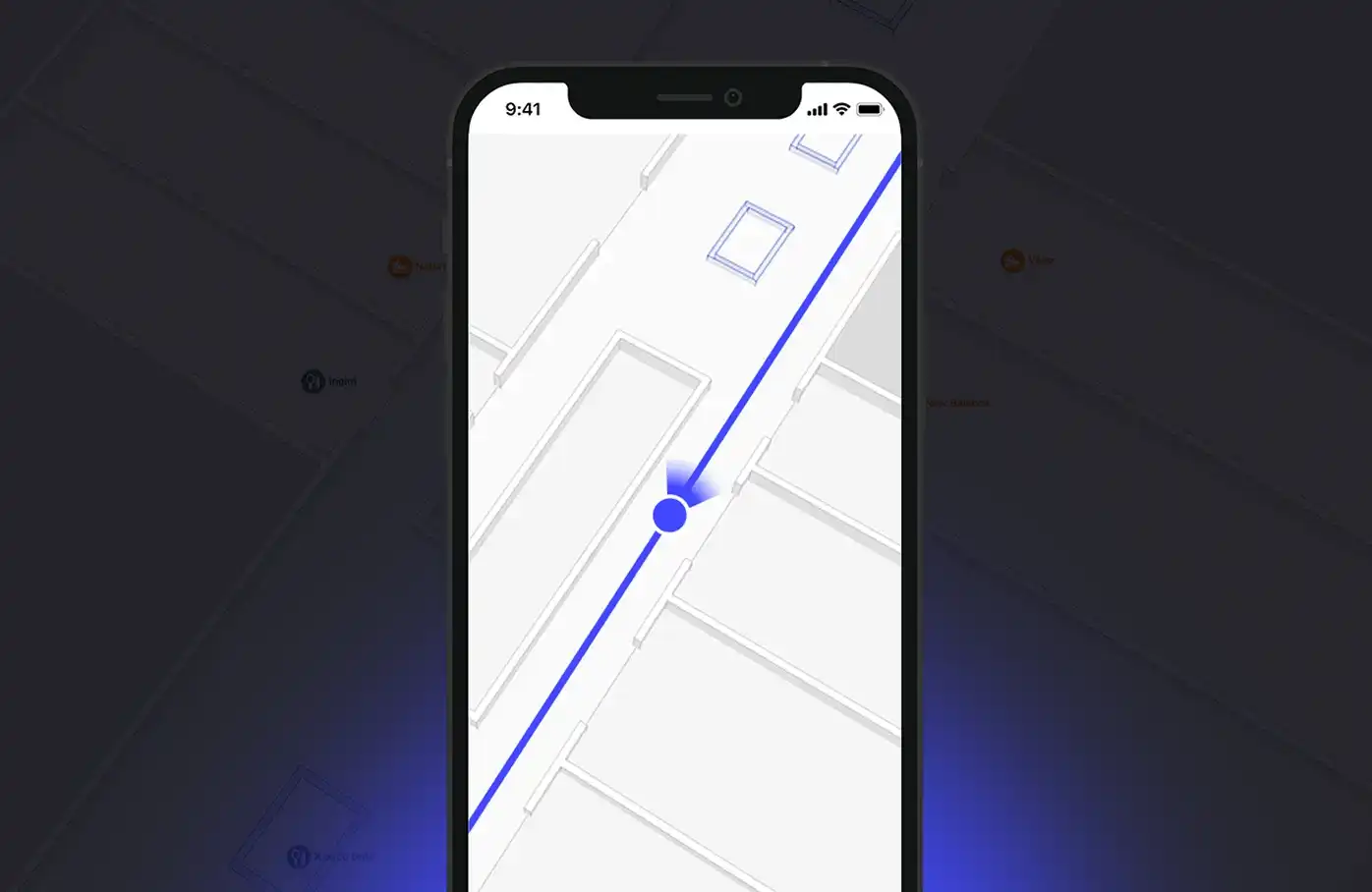
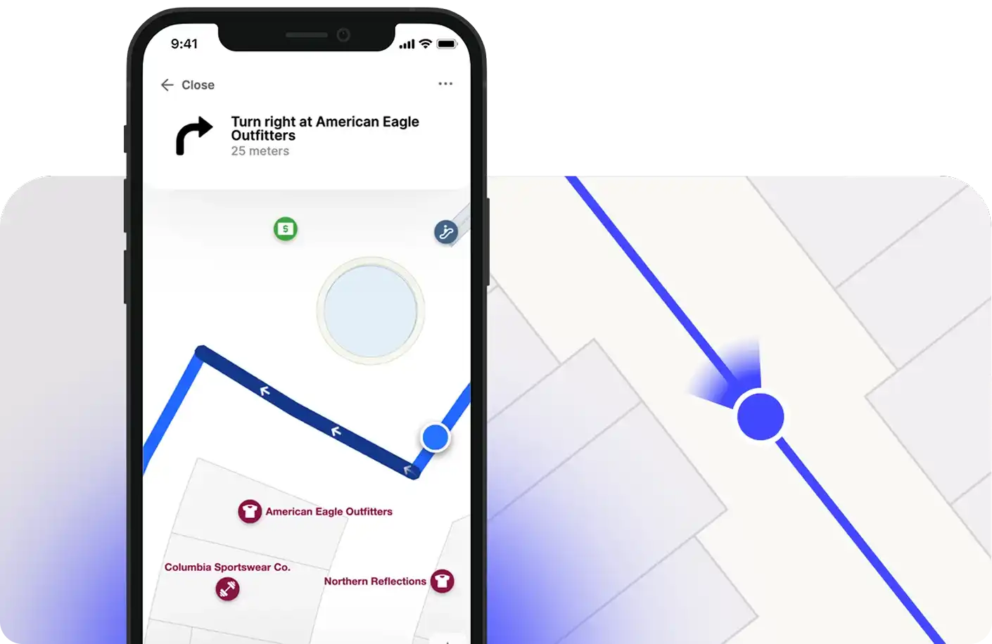
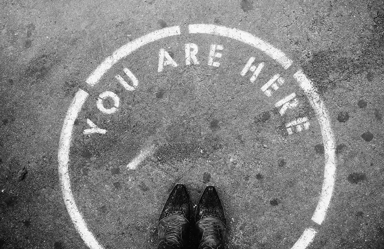
Blue dot reimagined for the indoors
Mappedin makes indoor positioning effortless—no hardware, no infrastructure, no hassle.
With our patented technology, we work with you to build a solution that’s perfectly designed for your space, big or small.

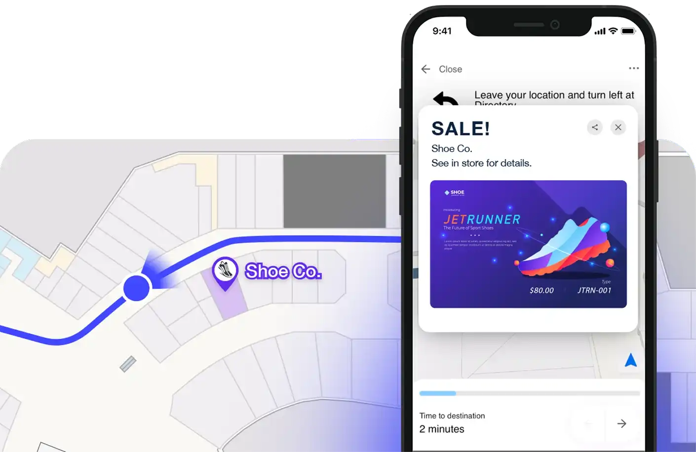
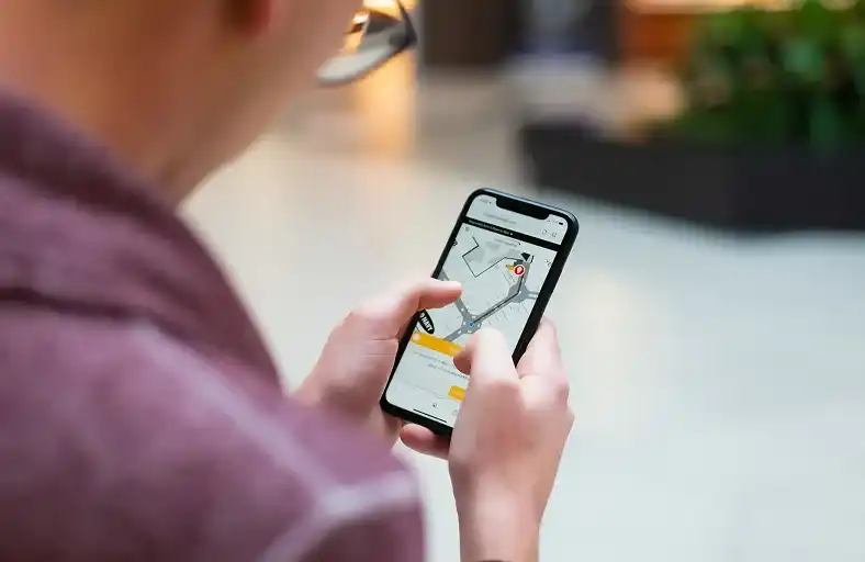
Include live positioning for any app
Powered by our latest SDK, developers can seamlessly enable blue dot on any map or application.


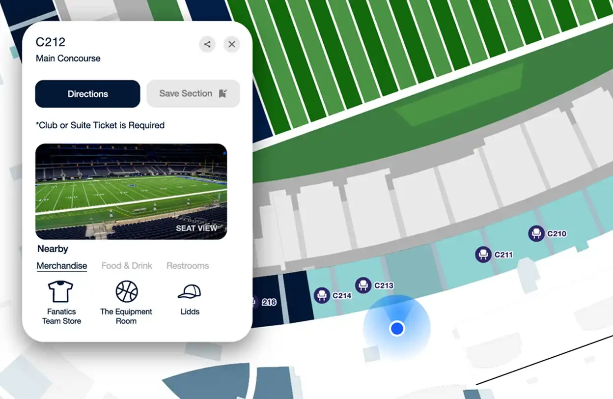
Mappedin’s responsive mapping solution with blue dot wayfinding allows us to provide interactive and intuitive wayfinding to visitors of Miracle Mile Shops. By integrating the maps with a conversational AI platform, it is simple for tourists and other guests to search, discover, and navigate our venue directly from our website.


You might also like


Frequently asked questions
What is an indoor positioning system (IPS)?
An indoor positioning system (IPS) is like GPS, but for inside buildings where satellite signals don’t work. It helps track people, devices, or assets using Wi-Fi, Fingerprinting, AI-powered mapping, Bluetooth, Ultra-Wideband (UWB), or Visual Positioning—depending on the setup.
How does indoor positioning work?
Most indoor positioning systems rely on hardware-based tracking (like beacons and sensors) or software-driven solutions that use Wi-Fi and mobile sensors. The more infrastructure a system needs, the more costly and complex it is to maintain. Infrastructure-free solutions are gaining traction because they reduce setup time and expenses.
Why use an indoor positioning system?
It makes indoor spaces easier to navigate, manage, and optimize. Businesses use IPS to:
- ✅ Guide visitors with turn-by-turn directions.
- ✅ Track high-value assets in real time.
- ✅ Optimize space and operations with location insights.
- ✅ Improve security by monitoring restricted areas.
Which industries benefit from indoor positioning?
It makes indoor spaces easier to navigate, manage, and optimize. Businesses use IPS to:
- Retail & malls - Help shoppers find stores, promotions, and exits.
- Hospitals - Guide patients and staff, track medical equipment.
- Airports & transit hubs - Reduce congestion, improve wayfinding.
- Corporate offices - Monitor workspace usage and enhance navigation.
What’s the most accurate indoor positioning technology?
It depends on accuracy vs. infrastructure needs:
- 📍 UWB (Ultra-Wideband) - Highly precise but requires dedicated sensors.
- 📍 Bluetooth (BLE) & RFID - Good for tracking within 1-5 meters but needs hardware.
- 📍 Wi-Fi & AI-powered solutions - Works in large spaces without extra setup.
Can indoor positioning work without beacons or sensors?
Yes. While traditional IPS relies on beacons and RFID tags, newer solutions use Wi-Fi signals, AI, and smartphone sensors to determine location without extra infrastructure. This makes them easier to deploy, more scalable, and cost-effective—ideal for spaces that change frequently or need a low-maintenance setup.
Mappedin combines visual positioning and fingerprinting to deliver the best of both worlds—an infrastructure-free indoor tracking solution that’s easy to deploy and incredibly accurate. No extra hardware, no complex setup—just seamless location tracking that works.
How do I choose the best indoor positioning system?
Start by asking:
- 📍 What level of accuracy do I need? (Centimeter-precise or general location?)
- 📍 Do I want a hardware-free solution? (Lower costs, faster setup.)
- 📍 How easily can it scale? (Will it work in multiple locations?)
- 📍 What’s my budget? (Consider long-term maintenance costs, not just initial setup.)
We’ve worked with some of the biggest, most complex venues out there. Let’s talk about what you need and find the right indoor positioning system for your space.
What’s the difference between indoor positioning and GPS?
- GPS works outside (uses satellites, great for open spaces).
- IPS works inside (uses Wi-Fi, BLE, or AI for real-time tracking).
If you need accurate indoor navigation or asset tracking, IPS is the way to go.
Does Google Maps offer indoor positioning?
Google offers Indoor Maps, but it relies mostly on Wi-Fi signals and manual mapping. For real-time tracking and navigation inside buildings, dedicated indoor positioning systems are typically more precise and flexible.
How much does an indoor positioning system cost?
Costs depend on:
- 💰 Technology - Hardware-based systems (BLE, UWB) cost more to install and maintain.
- 🏢 Size of deployment - A single-floor office vs. a multi-location rollout.
- ⚙️ Customization - Features like asset tracking, analytics, and integrations.
If you're looking for a low-maintenance, scalable solution, an infrastructure-free IPS can help reduce costs while keeping accuracy high.